< Previous | List | Next > To Schlüterhütte (Rifugio Genova)
Click to enlarge!
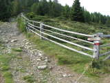
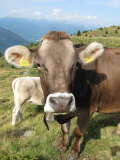
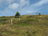
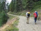
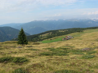 We left around 9:10am, glad that the weather had improved over night. The first part of the day's hike took us over the same plateau, over nice and easy double-track trails. The surrounding area was mostly green rolling hills, and used for grazing.
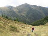
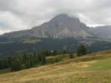
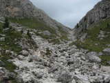
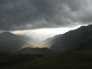
Two hours into our hike, the weather started taking a turn for the worse again. Dramatic clouds surrounded us, but we were spared the rain. At around 12:25, we stopped for lunch at Turnaretscher Hütte (Rif. Val Dal Le). This didn't take too long, only about half an hour. From here, the trail would mostly be single-track to Maurer Berghütte, which we reached at around 2pm. From here, Peitlerkofel (which we'd contour later on) was clearly visible. Since we'd have to climb up to 2361m to cross the Peitlerscharte, and saw a lot of clouds hanging over that spot, we decided to increase our pace so as to minimize the probability of getting caught by more bad weather.
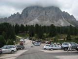
The road down to Würzjoch, at 1987m, was gravel; and while it was uninteresting to walk on at least it was just the right decline to permit walking fast without the additional strain a steeper descent would have. I was feeling great, and as such was walking slightly ahead of the other two guys. Just beyond the lowest part of the hike, the trail went up again, and I found myself setting a pace that the others were unable to follow. Once I reached Würzjoch - teeming with cars and day-hikers - I waited up; but then set off on my own again once the other two had caught up.
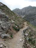
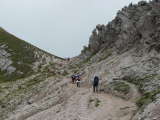
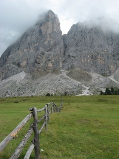 By now, the top of Peitlerkofel was covered in clouds. Fortunately, there was still no sign of rain; even if the sky around us remained mostly grey. As the trail got closer to the mountain, it also became narrower. There were a few spots where it was too narrow for two people to walk one alongside the other, which meant I had to stop at times to let more day hikers descent.
The final part of the ascent towards Peitlerscharte was quite rocky and steep, and I made it to the top at around 16:15. Patrick and Ralph were a little bit behind, but had kept up quite well. After a five-minute wait, and another five-minute rest, we set off together, following an easy trail towards Schlüterhütte (Rifugio Genova).
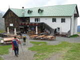
We still decided to keep up the pace and pass a couple of hiking groups that were sharing the same trail, since we guessed that it would be easier to get a good room when arriving before them. We arrived at 16:50, slightly over 7.5 hours after setting off; which easily bet the 8.5 hours the guide book had indicated (for a start closer to the hut than where we started, so in reality we were even faster).
 We were glad that we hadn't seen any rain all day long, even more glad that we got a nice three-bed room, but slightly annoyed that there only was one shower which didn't run very long to boot. Dinner was the busiest yet, and we shared the table with some Eastern hikers and a guy who had biked up and had all kinds of stories to tell about climbs that made some of us wish we had two wheels, rather that having to merely rely on our two feet.
Written 6th February 2009 in Bivange.
Accommodation: Schlüterhütte (Rifugio Genova)
- Kilometres hiked: 20km (12.4mi)
- Ascent: 1000m (3281ft)
- Descent: 600m (1969ft)